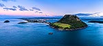
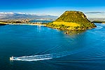
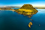
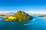
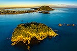
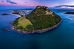
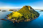
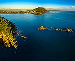
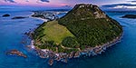
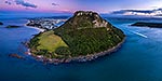
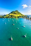
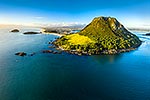
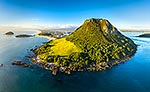
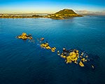
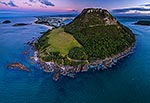
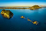
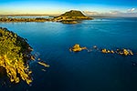
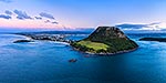
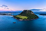
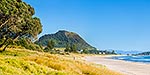
Mount Maunganui, or Mauao, at the Tauranga Harbour Entrance. 231m high lava dome. Moturiki and Motuotau Islands at left. Aerial view at dusk, Mount Maunganui, Tauranga District, Bay of Plenty Region, New Zealand (NZ), stock photo.
These images are protected by copyright, but we license them to suit your needs. Click
'quick quote' to learn more...
Mount Maunganui, or Mauao, at the Tauranga Harbour Entrance. 231m high lava dome. Moturiki and Motuotau Islands at left. Aerial view at dusk, Mount Maunganui, Tauranga District, Bay of Plenty Region, New Zealand (NZ) Stock Photo
Mount Maunganui, or Mauao, at the Tauranga Harbour Entrance. 231m high lava dome. Moturiki and Motuotau Islands at left. Aerial view at dusk, Mount Maunganui, Tauranga District, Bay of Plenty Region, New Zealand (NZ)
 stock photo.")


")