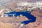
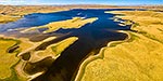
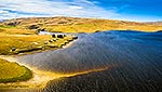
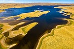
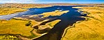
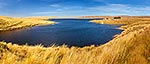
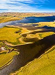
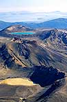
Lake Onslow, Manorburn. Teviot River south branch and Fortification creek entering lake at bottom left. Bottle Rock (974m) below, Roxburgh, Central Otago District, Otago Region, New Zealand (NZ), stock photo.
These images are protected by copyright, but we license them to suit your needs. Click
'quick quote' to learn more...
Lake Onslow, Manorburn. Teviot River south branch and Fortification creek entering lake at bottom left. Bottle Rock (974m) below, Roxburgh, Central Otago District, Otago Region, New Zealand (NZ) Stock Photo
Lake Onslow, Manorburn. Teviot River south branch and Fortification creek entering lake at bottom left. Bottle Rock (974m) below, Roxburgh, Central Otago District, Otago Region, New Zealand (NZ)
 below, Roxburgh, Central Otago District, Otago Region, New Zealand (NZ) stock photo.")

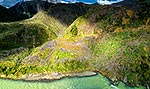


 below, Roxburgh, Central Otago District, Otago Region, New Zealand (NZ)")