
 stock photo.")
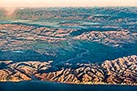
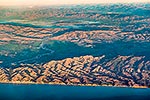
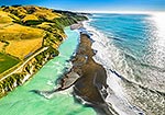
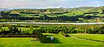
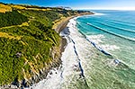
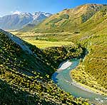
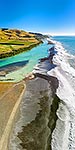
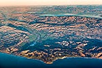
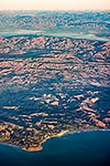
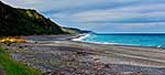
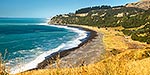
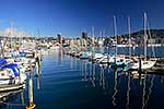
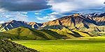
Hurunui Mouth coastline with Point Gibson Gore Bay right. Huruni River winding back past Domett and Lowry Peaks Range to Amuri Plains behind. Aerial view, Cheviot, North Canterbury, Hurunui District, Canterbury Region, New Zealand (NZ), stock photo.
 EMAIL TO FRIEND
- Location:
- Cheviot, North Canterbury (other locations)
- District:
- Hurunui (see districts)
- Region:
- Canterbury (see regions)
- Country:
- New Zealand (NZ)
- Notes:
- Large file (8192 x 5464 pixels native, no interpolation). | Ratio (height:width) 1:1.49
- Photographer:
- Rob Suisted
- Image #:
- 62360OP00
Keywords (advanced)
Related images


Similar images
Random images
")