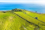
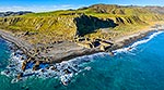
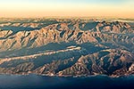
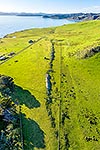
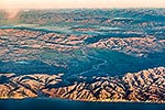
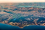
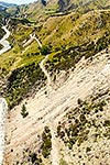
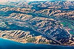
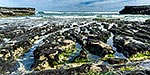
Baring Head earthquake faultline scarp. Looking south past lighthouse towards Cook Strait. East Harbour Regional Park. Aerial view, Baring Head, Hutt City District, Wellington Region, New Zealand (NZ), stock photo.
These images are protected by copyright, but we license them to suit your needs. Click
'quick quote' to learn more...
Baring Head earthquake faultline scarp. Looking south past lighthouse towards Cook Strait. East Harbour Regional Park. Aerial view, Baring Head, Hutt City District, Wellington Region, New Zealand (NZ) Stock Photo
Baring Head earthquake faultline scarp. Looking south past lighthouse towards Cook Strait. East Harbour Regional Park. Aerial view, Baring Head, Hutt City District, Wellington Region, New Zealand (NZ)
 stock photo.")


")