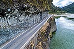
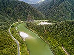
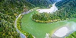
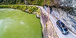
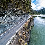
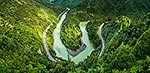
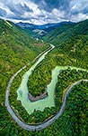
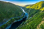
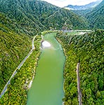
Buller River rounding Dee Point, with Hawks Crag visible on State Highway 6 (SH6) at left. Lower Buller Gorge aerial view, Westport, Buller District, West Coast Region, New Zealand (NZ), stock photo.
These images are protected by copyright, but we license them to suit your needs. Click
'quick quote' to learn more...
Buller River rounding Dee Point, with Hawks Crag visible on State Highway 6 (SH6) at left. Lower Buller Gorge aerial view, Westport, Buller District, West Coast Region, New Zealand (NZ) Stock Photo
Buller River rounding Dee Point, with Hawks Crag visible on State Highway 6 (SH6) at left. Lower Buller Gorge aerial view, Westport, Buller District, West Coast Region, New Zealand (NZ)
 at left. Lower Buller Gorge aerial view, Westport, Buller District, West Coast Region, New Zealand (NZ) stock photo.")

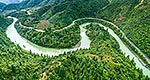
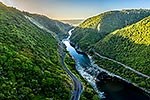
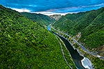

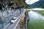
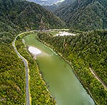
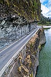
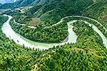
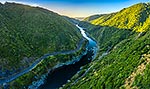
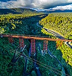
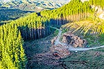
 at left. Lower Buller Gorge aerial view, Westport, Buller District, West Coast Region, New Zealand (NZ)")