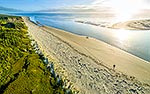
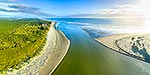
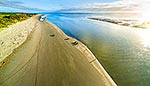
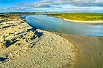
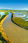
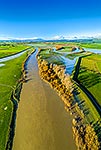
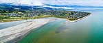
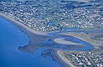
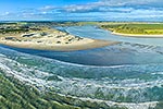
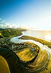
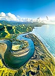
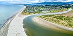
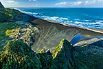
Manawatu River mouth, with Foxton Beach township at left, Tararua Ranges beyond, and Waitarere forest at right. Aerial view, Foxton Beach, Horowhenua District, Manawatu-Wanganui Region, New Zealand (NZ), stock photo.
These images are protected by copyright, but we license them to suit your needs. Click
'quick quote' to learn more...
Manawatu River mouth, with Foxton Beach township at left, Tararua Ranges beyond, and Waitarere forest at right. Aerial view, Foxton Beach, Horowhenua District, Manawatu-Wanganui Region, New Zealand (NZ) Stock Photo
Manawatu River mouth, with Foxton Beach township at left, Tararua Ranges beyond, and Waitarere forest at right. Aerial view, Foxton Beach, Horowhenua District, Manawatu-Wanganui Region, New Zealand (NZ)
 stock photo.")


")