
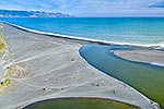
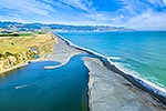
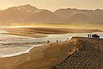
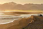
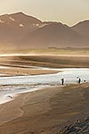
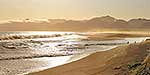
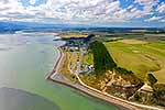
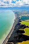
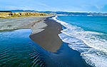
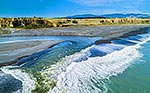
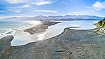
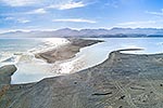
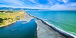
 and outlet into Palliser Bay. Looking along Whangaimoana Beach towards the Aorangi Ranges behind. Cape Palliser centre distance. Aerial panorama, Lake Ferry, South Wairarapa District, Wellington Region, New Zealand (NZ) stock photo.")
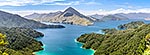
Lake Ferry (Onoke) and outlet into Palliser Bay. Looking along Whangaimoana Beach towards the Aorangi Ranges behind. Cape Palliser centre distance. Aerial panorama, Lake Ferry, South Wairarapa District, Wellington Region, New Zealand (NZ), stock photo.
- Location:
- Lake Ferry (other locations)
- District:
- South Wairarapa (see districts)
- Region:
- Wellington (see regions)
- Country:
- New Zealand (NZ)
- Notes:
- Ratio (height:width) 1:2.37
- Photographer:
- Rob Suisted
- Image #:
- 56516OP00
Keywords (advanced)
Related images

Similar images
Random images


 and outlet into Palliser Bay. Looking along Whangaimoana Beach towards the Aorangi Ranges behind. Cape Palliser centre distance. Aerial panorama, Lake Ferry, South Wairarapa District, Wellington Region, New Zealand (NZ)")