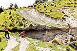
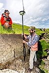
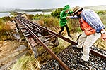
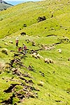
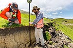
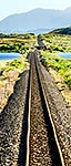
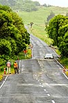
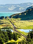
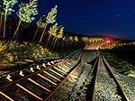
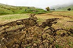
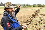
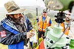
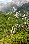
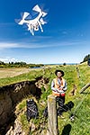
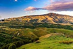
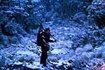
John Manousakis came from Greece to help characterise the Kekerengu Fault rupture with GNS scientists, using 3D drone mapping modelling. Farm dam destroyed by direct rupture hit. Kaikoura M7.8 earthquake, Tirohanga, Kekerengu, Kaikoura District, Canterbury Region, New Zealand (NZ), stock photo.
These images are protected by copyright, but we license them to suit your needs. Click
'quick quote' to learn more...
John Manousakis came from Greece to help characterise the Kekerengu Fault rupture with GNS scientists, using 3D drone mapping modelling. Farm dam destroyed by direct rupture hit. Kaikoura M7.8 earthquake, Tirohanga, Kekerengu, Kaikoura District, Canterbury Region, New Zealand (NZ) Stock Photo
John Manousakis came from Greece to help characterise the Kekerengu Fault rupture with GNS scientists, using 3D drone mapping modelling. Farm dam destroyed by direct rupture hit. Kaikoura M7.8 earthquake, Tirohanga, Kekerengu, Kaikoura District, Canterbury Region, New Zealand (NZ)
 stock photo.")


")