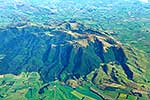
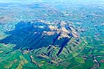
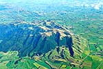
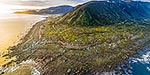
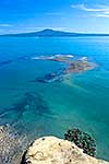
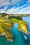
Croydon Bush, Hokonui Hills, Waterfall Range and Dolamore Park, aerial view showing geological Southland Syncline, folded limestone layers, Croydon, Gore District, Southland Region, New Zealand (NZ), stock photo.
These images are protected by copyright, but we license them to suit your needs. Click
'quick quote' to learn more...
Croydon Bush, Hokonui Hills, Waterfall Range and Dolamore Park, aerial view showing geological Southland Syncline, folded limestone layers, Croydon, Gore District, Southland Region, New Zealand (NZ) Stock Photo
Croydon Bush, Hokonui Hills, Waterfall Range and Dolamore Park, aerial view showing geological Southland Syncline, folded limestone layers, Croydon, Gore District, Southland Region, New Zealand (NZ)
 stock photo.")


")
