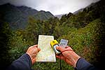
Map reading and using GPS and compass to find way in rainforest. NZMS 260 topographic map, magnetic compass and Etrex GPS unit, Westland District, West Coast Region, New Zealand (NZ), stock photo.
These images are protected by copyright, but we license them to suit your needs. Click
'quick quote' to learn more...
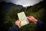
Map reading and using GPS and compass to find way in rainforest. NZMS 260 topographic map, magnetic compass and Etrex GPS unit, Westland District, West Coast Region, New Zealand (NZ) Stock Photo
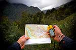
Map reading and using GPS and compass to find way in rainforest. NZMS 260 topographic map, magnetic compass and Etrex GPS unit, Westland District, West Coast Region, New Zealand (NZ)
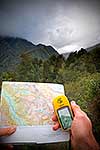
 stock photo.")


")
