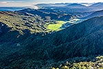
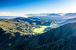
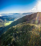
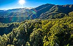
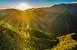
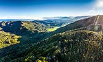
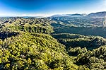
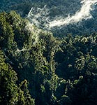
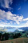
Karamea Highway descending Karamea Bluff to Corbyvale clearing, and then onto Karamea Flats beyond at left. Aerial view from Radiant Range Mokihinui Forest, Corbyvale, Buller District, West Coast Region, New Zealand (NZ), stock photo.
These images are protected by copyright, but we license them to suit your needs. Click
'quick quote' to learn more...
Karamea Highway descending Karamea Bluff to Corbyvale clearing, and then onto Karamea Flats beyond at left. Aerial view from Radiant Range Mokihinui Forest, Corbyvale, Buller District, West Coast Region, New Zealand (NZ) Stock Photo
Karamea Highway descending Karamea Bluff to Corbyvale clearing, and then onto Karamea Flats beyond at left. Aerial view from Radiant Range Mokihinui Forest, Corbyvale, Buller District, West Coast Region, New Zealand (NZ)
 stock photo.")
")