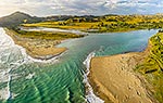
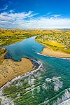
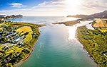
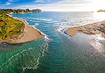
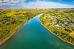
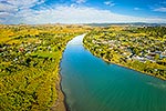
Tolaga Bay township and the Uawa River mouth. Hauiti at left. Aerial view with State Highway 35 (SH35) bridge crossing, Tolaga Bay, Gisborne District, Gisborne Region, New Zealand (NZ), stock photo.
These images are protected by copyright, but we license them to suit your needs. Click
'quick quote' to learn more...
Tolaga Bay township and the Uawa River mouth. Hauiti at left. Aerial view with State Highway 35 (SH35) bridge crossing, Tolaga Bay, Gisborne District, Gisborne Region, New Zealand (NZ) Stock Photo
Tolaga Bay township and the Uawa River mouth. Hauiti at left. Aerial view with State Highway 35 (SH35) bridge crossing, Tolaga Bay, Gisborne District, Gisborne Region, New Zealand (NZ)
 bridge crossing, Tolaga Bay, Gisborne District, Gisborne Region, New Zealand (NZ) stock photo.")


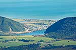


 bridge crossing, Tolaga Bay, Gisborne District, Gisborne Region, New Zealand (NZ)")