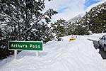
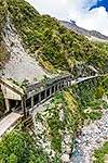
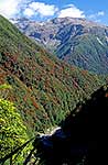
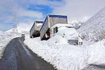
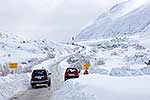
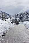
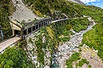
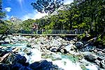
Arthurs Pass (920m) and Otira viaduct on the Arthurs Pass highway (SH73) in the Otira Gorge, spanning 440 metres, completed 1999. Aerial view looking south into Canterbury, Arthurs Pass National Park, Westland District, West Coast Region, New Zealand (NZ), stock photo.
These images are protected by copyright, but we license them to suit your needs. Click
'quick quote' to learn more...
Arthurs Pass (920m) and Otira viaduct on the Arthurs Pass highway (SH73) in the Otira Gorge, spanning 440 metres, completed 1999. Aerial view looking south into Canterbury, Arthurs Pass National Park, Westland District, West Coast Region, New Zealand (NZ) Stock Photo
Arthurs Pass (920m) and Otira viaduct on the Arthurs Pass highway (SH73) in the Otira Gorge, spanning 440 metres, completed 1999. Aerial view looking south into Canterbury, Arthurs Pass National Park, Westland District, West Coast Region, New Zealand (NZ)
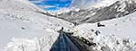
 and Otira viaduct on the Arthurs Pass highway (SH73) in the Otira Gorge, spanning 440 metres, completed 1999. Aerial view looking south into Canterbury, Arthurs Pass National Park, Westland District, West Coast Region, New Zealand (NZ) stock photo.")


 and Otira viaduct on the Arthurs Pass highway (SH73) in the Otira Gorge, spanning 440 metres, completed 1999. Aerial view looking south into Canterbury, Arthurs Pass National Park, Westland District, West Coast Region, New Zealand (NZ)")