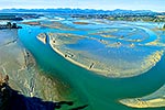
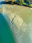
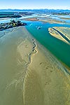
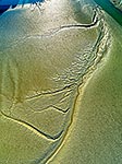
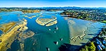
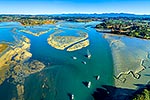
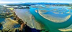
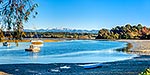
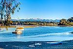
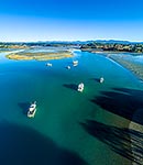
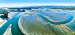
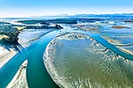
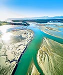
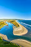
Waimea Inlet estuary, with Mapua (far left), Grossi Point, Rabbit Island Rough Island and Nelson beyond. Aerial view over sand and mudflats at low tide, Mapua, Tasman District, Tasman Region, New Zealand (NZ), stock photo.
These images are protected by copyright, but we license them to suit your needs. Click
'quick quote' to learn more...
Waimea Inlet estuary, with Mapua (far left), Grossi Point, Rabbit Island Rough Island and Nelson beyond. Aerial view over sand and mudflats at low tide, Mapua, Tasman District, Tasman Region, New Zealand (NZ) Stock Photo
Waimea Inlet estuary, with Mapua (far left), Grossi Point, Rabbit Island Rough Island and Nelson beyond. Aerial view over sand and mudflats at low tide, Mapua, Tasman District, Tasman Region, New Zealand (NZ)
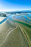
, Grossi Point, Rabbit Island Rough Island and Nelson beyond. Aerial view over sand and mudflats at low tide, Mapua, Tasman District, Tasman Region, New Zealand (NZ) stock photo.")

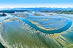

, Grossi Point, Rabbit Island Rough Island and Nelson beyond. Aerial view over sand and mudflats at low tide, Mapua, Tasman District, Tasman Region, New Zealand (NZ)")