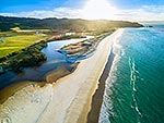
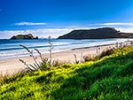
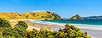
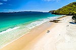
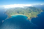
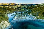
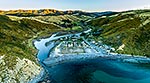
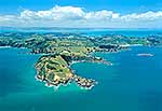
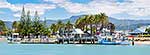
Whaorei Bay and Kauwera Point (left) with Opito Bay behind. Coastal Coromandel farmland. Mercury Islands at left. Aerial panorama, Otama Beach, Coromandel Peninsula, Thames-Coromandel District, Waikato Region, New Zealand (NZ), stock photo.
These images are protected by copyright, but we license them to suit your needs. Click
'quick quote' to learn more...
Whaorei Bay and Kauwera Point (left) with Opito Bay behind. Coastal Coromandel farmland. Mercury Islands at left. Aerial panorama, Otama Beach, Coromandel Peninsula, Thames-Coromandel District, Waikato Region, New Zealand (NZ) Stock Photo
Whaorei Bay and Kauwera Point (left) with Opito Bay behind. Coastal Coromandel farmland. Mercury Islands at left. Aerial panorama, Otama Beach, Coromandel Peninsula, Thames-Coromandel District, Waikato Region, New Zealand (NZ)
 with Opito Bay behind. Coastal Coromandel farmland. Mercury Islands at left. Aerial panorama, Otama Beach, Coromandel Peninsula, Thames-Coromandel District, Waikato Region, New Zealand (NZ) stock photo.")

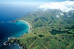


 with Opito Bay behind. Coastal Coromandel farmland. Mercury Islands at left. Aerial panorama, Otama Beach, Coromandel Peninsula, Thames-Coromandel District, Waikato Region, New Zealand (NZ)")