
 stock photo.")
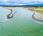
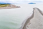
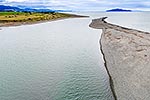
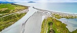
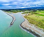
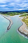
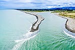
Otaki River mouth and estuary, with fishers on sandspit. Otaki farmland and Tararua Forest Park Ranges beyond. Aerial view, Otaki Beach, Kapiti Coast District, Wellington Region, New Zealand (NZ), stock photo.
 EMAIL TO FRIEND
- Location:
- Otaki Beach (other locations)
- District:
- Kapiti Coast (see districts)
- Region:
- Wellington (see regions)
- Country:
- New Zealand (NZ)
- Notes:
- Large file (7571 x 5047 pixels native, no interpolation. | Ratio (height:width) 1:1.5
- Photographer:
- Rob Suisted
- Image #:
- 56273OP00
Keywords (advanced)
Related images


Similar images

Random images


")