
 centre right, Tummel Burn and Rob Roy Peak far right. Panorama, Shotover River, Queenstown Lakes District, Otago Region, New Zealand (NZ) stock photo.")
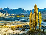
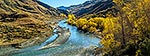
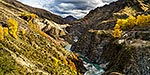
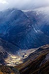
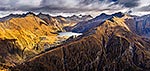
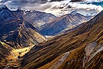
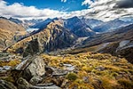
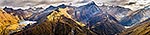
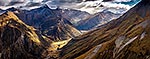
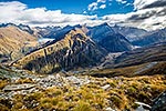
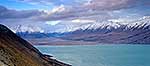
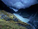
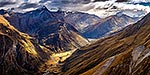
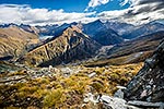
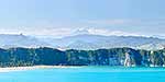
Shotover River valley headwaters. Lochnagar left, Pine Creek centre, Junction Flat at right. Mt Tyndall (2496m) centre right, Tummel Burn and Rob Roy Peak far right. Panorama, Shotover River, Queenstown Lakes District, Otago Region, New Zealand (NZ), stock photo.
- Location:
- Shotover River (other locations)
- District:
- Queenstown Lakes (see districts)
- Region:
- Otago (see regions)
- Country:
- New Zealand (NZ)
- Notes:
- Very large file (23589 x 3882 pixels native, no interpolation. | Ratio (height:width) 1:6.07
- Photographer:
- Rob Suisted
- Image #:
- 55049AT00
Keywords (advanced)
Related images
Similar images
Random images

 centre right, Tummel Burn and Rob Roy Peak far right. Panorama, Shotover River, Queenstown Lakes District, Otago Region, New Zealand (NZ)")