
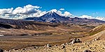
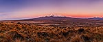
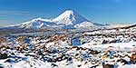
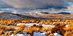
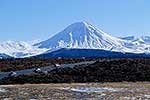
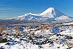
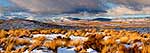
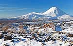
, Mt Ngauruhoe (2287m) and Mt Tongariro (1967m) (right), with snow covered Rangipo desert and volcanic plateau. Panorama, Tongariro National Park, Taupo District, Waikato Region, New Zealand (NZ) stock photo.")
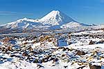
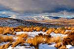
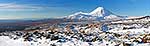
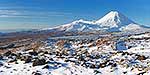
Mount Ruapehu (2797m-left), Mt Ngauruhoe (2287m) and Mt Tongariro (1967m) (right), with snow covered Rangipo desert and volcanic plateau. Panorama, Tongariro National Park, Taupo District, Waikato Region, New Zealand (NZ), stock photo.
- Location:
- Tongariro National Park (other locations)
- District:
- Taupo (see districts)
- Region:
- Waikato (see regions)
- Country:
- New Zealand (NZ)
- Notes:
- Very large digital file (15720 x 3811 pixels native, no interpolation) | Ratio (height:width) 1:3.97
- Photographer:
- Rob Suisted
- Image #:
- 37156VM00
Keywords (advanced)
Related images

Similar images

Random images


, Mt Ngauruhoe (2287m) and Mt Tongariro (1967m) (right), with snow covered Rangipo desert and volcanic plateau. Panorama, Tongariro National Park, Taupo District, Waikato Region, New Zealand (NZ)")