Contents
Browse
Best of...our Favs
People & Places
NZ Landscapes
Wild Wilderness
Outdoor Recreation
Wildlife
Flora
Design Ideas
Textures
Patterns
Panoramas
Random 40
Latest Images
Antarctica
NZ Regions
Northland
Auckland
Waikato
Bay of Plenty
Gisborne-East Coast
Hawke's Bay
Taranaki
Manawatu-Wanganui
Wellington-Wairarapa
Marlborough
Nelson
Tasman
Canterbury
West Coast
Otago
Southland
NZ Sub Antarctic
Antarctica
NZ Districts
About Us
Blog
Lightbox Empty
(0)
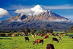
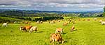
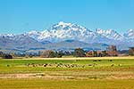
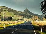
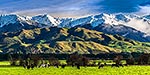
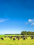
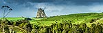
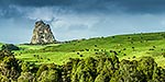
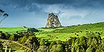
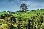
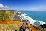
Dairy farming, dairy cattle and farmland below dramatic Maungaraho Rock (221m) peak. Native forest remnant below. Square format, Dargaville, Kaipara District, Northland Region, New Zealand (NZ), stock photo.
ADD TO LIGHTBOX
Add to lightbox
Get Quick Quote
EMAIL TO FRIEND
Location:
Dargaville
(other locations)
District:
Kaipara
(see districts)
Region:
Northland
(see regions)
Country:
New Zealand (NZ)
Notes:
Massive file (9727 x 8399 pixels native with no interpolation) | Ratio (height:width) 1:1.16
Photographer:
Rob Suisted
Image #:
52539GL00
Keywords
(
advanced
)
Forest-general
,
Geology
,
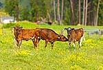
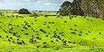
Animal-farm
,
Cattle
,
Dairy-farming
,
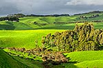
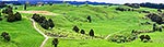
Farm-land/pasture
,
Dargaville
Kaipara District
Northland Region
Related images
Similar images
work with SIMILARS
Random images
more RANDOM images
These images are protected by copyright, but we license them to suit your needs. Click
'quick quote'
to learn more...
Dairy farming, dairy cattle and farmland below dramatic Maungaraho Rock (221m) peak. Native forest remnant below. Square format, Dargaville, Kaipara District, Northland Region, New Zealand (NZ) Stock Photo
Dargaville, Kaipara District, Northland Region, New Zealand (NZ)
Dairy farming, dairy cattle and farmland below dramatic Maungaraho Rock (221m) peak. Native forest remnant below. Square format, Dargaville, Kaipara District, Northland Region, New Zealand (NZ) Stock Photo
Rob Suisted
Dairy farming, dairy cattle and farmland below dramatic Maungaraho Rock (221m) peak. Native forest remnant below. Square format, Dargaville, Kaipara District, Northland Region, New Zealand (NZ)
 peak. Native forest remnant below. Square format, Dargaville, Kaipara District, Northland Region, New Zealand (NZ) stock photo.")
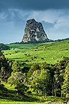
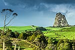


 peak. Native forest remnant below. Square format, Dargaville, Kaipara District, Northland Region, New Zealand (NZ)")