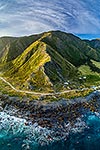
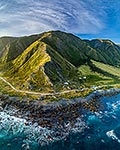
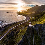
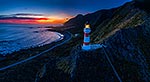
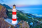
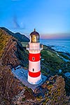
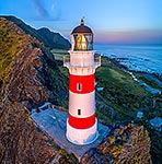
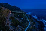
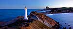
Cape Palliser lighthouse on the southern most point of the North Island (Matakitakiakupe). Aerial view at dusk with Aoraki Ranges (Haurangi Forest Park) beyond, Cape Palliser, South Wairarapa District, Wellington Region, New Zealand (NZ), stock photo.
These images are protected by copyright, but we license them to suit your needs. Click
'quick quote' to learn more...
Cape Palliser lighthouse on the southern most point of the North Island (Matakitakiakupe). Aerial view at dusk with Aoraki Ranges (Haurangi Forest Park) beyond, Cape Palliser, South Wairarapa District, Wellington Region, New Zealand (NZ) Stock Photo
Cape Palliser lighthouse on the southern most point of the North Island (Matakitakiakupe). Aerial view at dusk with Aoraki Ranges (Haurangi Forest Park) beyond, Cape Palliser, South Wairarapa District, Wellington Region, New Zealand (NZ)
. Aerial view at dusk with Aoraki Ranges (Haurangi Forest Park) beyond, Cape Palliser, South Wairarapa District, Wellington Region, New Zealand (NZ) stock photo.")


. Aerial view at dusk with Aoraki Ranges (Haurangi Forest Park) beyond, Cape Palliser, South Wairarapa District, Wellington Region, New Zealand (NZ)")